Leave Your Message
Industrial Edge Computing & Geospatial Positioning

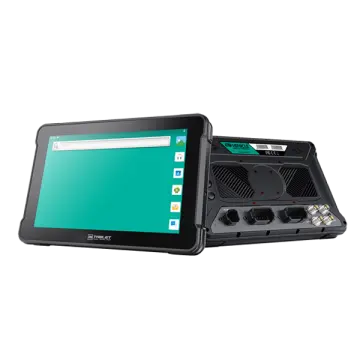
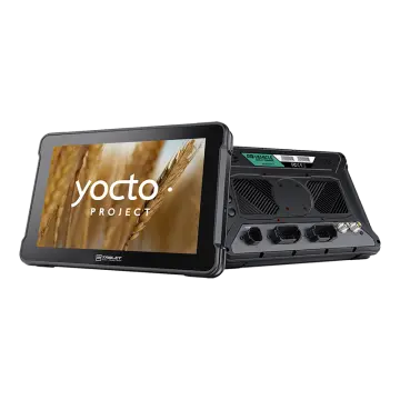
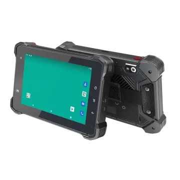
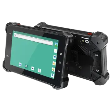
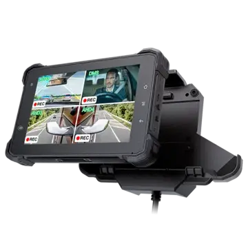
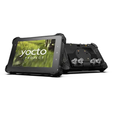
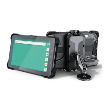
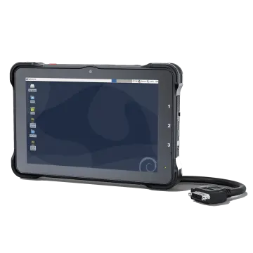
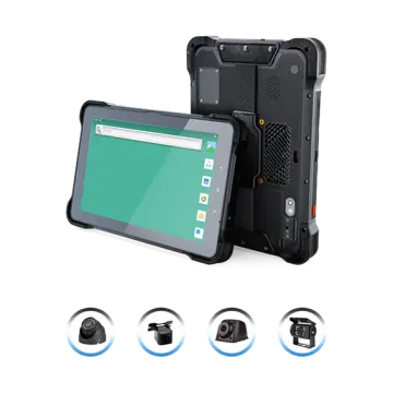
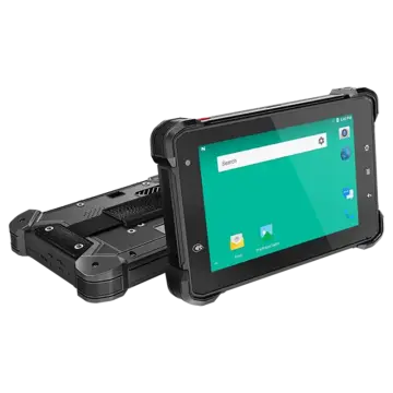
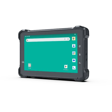
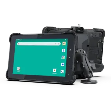
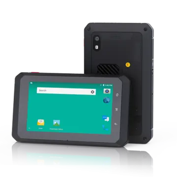
1000 Nits Vehicle Rugged Tablet Android For High-Precision GNSS Surveying

Empowering agricultural auto-guidance, civil earthmoving, autonomous telematics, and centimeter-accurate geospatial mapping under severe sunlight and extreme machine vibrations.

High-Precision Field Terminals

Rugged GNSS Display Terminals for Machine Guidance & Surveying

Engineered with high-luminance sunlight-readable panels, multi-constellation RTK receivers, and robust CAN-bus interfaces tailored for mission-critical surveying operations.

Market Dynamics & Architecture

The Industrial Paradigm: 1000 Nits Optical Bonding & Centimeter GNSS

Modern industrial survey workflows have shifted radically from static, handheld data logging toward dynamic, vehicle-mounted autonomous edge computing platforms.

Across precision agriculture, infrastructure engineering, geotechnical site modeling, and open-cast mining, the demand for instant, sub-inch geospatial coordinates is unprecedented. Deploying standard commercial tablets in in-vehicle machine control leads to inevitable operational paralysis: displays wash out under direct ambient sunlight, standard capacitive touchscreens malfunction in damp environments, and internal batteries degrade rapidly when subjected to wide thermal fluctuations and continuous cabin vibration. A specialized 1000 Nits Vehicle Rugged Tablet Android for High-Precision GNSS Surveying bridges the gap between rugged mobile compute performance and laboratory-grade geodetic accuracy.

1000 Nits Ultra-Bright Optical Bonding

Emits ultra-high photometric luminance (1000 cd/m²) combined with anti-glare, anti-reflective (AG/AR) glass treatments. Full optical bonding eliminates air gaps between the LCD panel and capacitive touch layer, suppressing internal reflection, preventing condensation build-up, and rendering complex GIS survey maps razor-sharp even under direct midday sun.

Centimeter RTK & Multi-Constellation

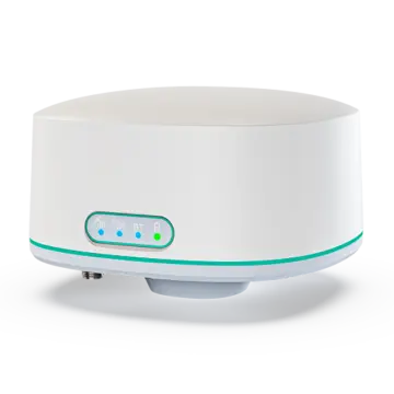
Integrated with multi-frequency L1/L2/L5 geodetic GNSS modules tracking GPS, GLONASS, Galileo, BeiDou, and QZSS constellations. With integrated RTCM differential correction decoders, NTRIP client protocols, and dual-antenna heading configurations, operators achieve steady 1-to-2 centimeter positioning accuracy in real time.

Automotive CAN Bus & ISOBUS Interfacing

Engineered with dual CAN Bus (SAE J1939, CANopen, ISO 11783 ISOBUS standard) interfaces, high-voltage wide power input (8-36V DC) with ISO 7637-2 transient spike protection, and smart ignition detection (ACC sensing). Serves directly as a virtual terminal (VT) and task controller (TC-BAS/TC-GEO) in heavy machinery cabins.

In the context of modern industrial surveying, latency and thermal throttling represent critical vulnerabilities. A vehicle maneuvering across rough terrain at speed relies on constant position recalculations. The Android architecture utilized in these industrial tablets features multi-core Qualcomm Snapdragon or NXP i.MX application processors running stripped, hardened Android operating systems (Android 11, 12, or above). This setup optimizes raw computational bandwidth for processing real-time kinematic (RTK) corrections, digital elevation models (DEM), point clouds, and telemetry streaming simultaneously, all while maintaining cool operational envelopes without failure-prone mechanical fans.
Real-World Operational Implementations

Mission-Critical Scenarios for High-Precision Vehicle Tablets

Investigating four primary sectors where 1000 Nits sunlight visibility, industrial Android stability, and centimeter georeferencing transform field economics.

1. Precision Agriculture: Autosteering, Boundary Surveying & Variable-Rate Application

In modern smart farming, operators mount 1000 Nits rugged Android tablets directly inside tractor, sprayer, and harvester cabs. Connected to dual-antenna GNSS receivers and agricultural steering valves via ISOBUS CAN, the tablet manages centimeter-level path planning, swath tracking, boundary mapping, and section control. The 1000 Nits high-luminance screen allows farm operators to review high-contrast vegetative indices (NDVI) and prescription maps effortlessly through dusty, glass-dominated cabs without squinting or manual shading. IP67 ingress protection guards internal electronics against airborne agrochemical dust and moisture washdown cycles.

2. Civil Engineering & Heavy Earthmoving Machine Guidance (3D Excavation & Grading)

Excavators, bulldozers, and motor graders engaged in roadbed construction and foundational civil works operate in environments fraught with severe mechanical shocks and blinding outdoor sun. With a rugged Android tablet executing 3D machine control software, the operator visualizes design surfaces, cut-and-fill depths, and CAD cross-sections in real time. The integration of high-precision RTK GNSS and IMU tilt compensation provides exact blade and bucket positioning down to millimeter tolerances, drastically eliminating the need for manual stakeout surveyors and expediting project delivery schedules.

3. Open-Pit Mining: Haul Truck Fleet Positioning, Drill Rig Guidance & Safety Telematics

Mining operations require round-the-clock reliability across scorching daytime heat and pitch-black nights. Vehicle rugged tablets mounted in mining haul trucks, wheel loaders, and blast-hole drills serve as unified visual dispatch, proximity detection, and survey telemetry terminals. High-precision GNSS tracks asset coordinates within open pits to prevent haul-road collisions, verify blasted ore boundaries, and guide automated drill bit depths. The ruggedized chassis, compliant with MIL-STD-810G/H, sustains continuous low-frequency structural vibration caused by diesel engines and rocky terrains.

4. Municipal Infrastructure GIS Mapping & Utility Asset Surveying

Utility service trucks mapping subterranean water mains, electrical grids, gas distribution pipelines, and fiber telecom conduits utilize Android rugged tablets mounted on vehicle consoles or dismounted onto survey poles. Combining 4G/5G mobile connectivity, Bluetooth 5.0, Wi-Fi 6, and centimeter GNSS, technicians capture survey-grade spatial coordinates directly into ESRI ArcGIS or custom GIS cloud applications. Real-time differential corrections via regional NTRIP networks ensure that captured utility coordinates meet stringent state geodetic survey standards.

Evolution & Future Directions

Technological Trajectories: Where GNSS Computing is Headed

The ongoing evolution of geospatial survey terminals is dominated by three transformative technology vectors:
  • AI-Accelerated Edge Telematics: Incorporating Neural Processing Units (NPUs) directly into vehicle tablets enables on-device computer vision. When coupled with Multi-Channel AHD cameras, the system can perform real-time visual simultaneous localization and mapping (vSLAM), obstacle identification, and photogrammetric surveying during standard route traversal.
  • Precise Point Positioning (PPP) & Satellite Correction Services: Beyond local RTK base stations, next-generation tablets natively decode L-band satellite PPP-RTK corrections (e.g., Galileo HAS, Trimble CenterPoint RTX), enabling instant decimeter and centimeter accuracy in remote wilderness lacking cellular NTRIP coverage.
  • Unified Android Enterprise & MDM Integration: Modern fleet managers demand remote firmware deployment, application sandboxing, and automated security patching. Enterprise-grade Mobile Device Management (MDM) ensures mission-critical fleet devices stay secured against field exploits.
  • Sensor Fusion with Advanced IMU Dead Reckoning: Even when high-rise urban canyons, heavy forestry, or mining quarry benches obstruct satellite lines of sight, tightly coupled GNSS+MEMS IMU sensors maintain centimeter accuracy through intelligent inertial dead reckoning.

Why Android Outperforms Legacy OS in Modern Surveying

Historically, legacy vehicle terminals relied on proprietary firmware or Windows CE / Embedded platforms, which suffered from cumbersome application lifecycles, restricted hardware driver ecosystems, and poor graphical responsiveness.

Android has emerged as the premier operating environment for field surveying. It provides an intuitive capacitive multi-touch interface optimized for gloved operations and wet weather gestures, rapid hardware acceleration for complex spatial vector rendering, and universal compatibility with popular spatial field applications (SurvX, FieldGenius for Android, QField, AgriBus-NAVI, Topcon Field, and Trimble Siteworks).

Corporate Background

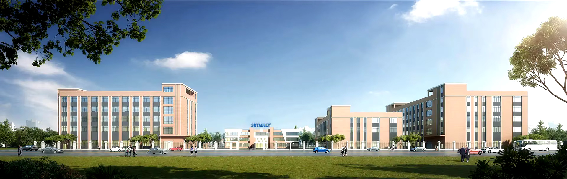
3Rtablet is a globally leading rugged tablet manufacturer

Technology-based, market-oriented, innovative enterprise that develops and manufactures rugged Internet of Vehicles (IOV) terminals and IOT system solutions. With more than 18 years of professional experience, 3Rtablet has cooperated with many top brand telematics solution providers around the world, and the products are widely recognized for their stable performance and professional technical support.
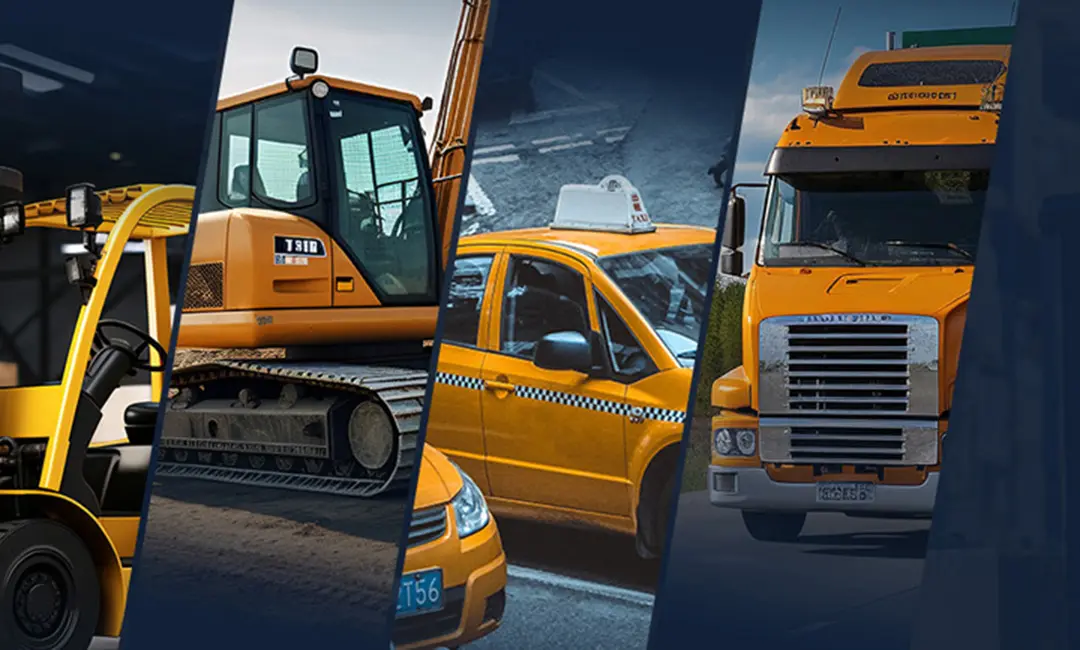
The main products include IP67 rugged tablets, MDM Rugged Device, Intelligent Vehicle Telematics Terminal, and RTK Base Station and Receiver, On-board Computers, Mobile Data Terminal, Agriculture display, Vehicle-mounted Tablets, AHD Camera Integrated Tablets, IP67/IP69K Android telematics boxes, MDVR and AI Dashcam. AI algorithmic vehicle video surveillance and recording technology and comprehensive IoT solutions for a wide range of fleet management application, including ELD/HOS in trucks, construction equipment, mining, forklift safety, taxi dispatch, agriculture precision, intelligent transportation systems, etc. Offering OEM/ODM services, we customize products to meet specific needs.
About 3Rtablet High Precision GNSS Manufacturer

18 Years

Of Production Experience
Technical Competence & Global Footprint

Our Advantage

3Rtablet R&D team with more than 18 years field experience to do technical support, and has been ready to support you in building professional solutions in specific markets.

Regions We Serve

Regions We Serve

3Rtablet has served customers among more than 70 countries in North America, Europe, Latin America, Oceania, Africa, and the Asia Pacific region.

Industries We Related

Industries We Related

Fleet Management, Precision Agriculture, Mining, Taxi Dispatch, Forklift Safety, Construction, Public Transportation, Heavy Machinery & Trucks, Crane, Waste management, Vehicle tracking's and Emergency Response Solutions etc.

Service We Provide

Service We Provide

3Rtablet's Hardware devices are mainly powered by NXP, Qualcomm, TI solutions, Functional requirements, Hardware test-bed evaluation, Schematic diagram design, Brand requirements for more requirements, please refer to OEM/ODM service.

// OUR BUSINESS //   Our Value

3Rtablet follows innovative technologies, complete solutions, friendly products, excellent quality, and professional services to continuously improve product quality and customer satisfaction, delivering customers with Rugged, Reliable, and Ready Internet of Vehicle (IOV) devices. 3Rtablet has three core values at the heart of its operation: We are 'Sincere', we 'Share' and always strive for 'Success' with our business partners.